GOES 13 sees the life and death of hurricane Sandy
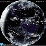
This video of satellite imagery from the GOES 13 satellite shows the life of Hurricane Sandy from its development in the Caribbean Sea on Oct. 21, through its track up…
This video of satellite imagery from the GOES 13 satellite shows the life of Hurricane Sandy from its development in the Caribbean Sea on Oct. 21, through its track up…
Source NASA – Tropical Rainfall Measuring Mission, or TRMM satellite can measure rainfall rates and cloud heights in tropical cyclones, and was used to create an image to look into…
NASA/NOAA– The average area covered by the Antarctic ozone hole this year was the second smallest in the last 20 years, according to data from NASA and National Oceanic and…
In the 1930s the Great Plains became know as the great dust bowl when hugs dust storms were created from a long period of heat an drought. In October 2012…
Understanding historical hurricane landfalls is important in preparing for current storms NOAA – Seeing where hurricanes have hit and how often is one of the best ways to bring home…
WASHINGTON — For several days this month, Greenland’s surface ice cover melted over a larger area than at any time in more than 30 years of satellite observations. Nearly the…
WASHINGTON — NASA and the Interior Department Monday marked the 40th anniversary of the Landsat program, the world’s longest-running Earth-observing satellite program. The first Landsat satellite was launched July 23,…
WASHINGTON — NASA soon will open a new chapter of discovery using enhanced Landsat Earth-observing data in a state-of-the-art, high-performance computing and data access facility called NASA Earth Exchange (NEX)….


KnowledgeOrb Powered by WordPress
Max Magazine Theme was created by ![]()