
Eclipse Viewed from Space 2024
Live Eclipse streaming images of the 2024 Eclipse. Track the Eclipse totality as it crosses the United States. Continental U.S. and Mexico from GOES-R Satellites. Should come into view about…
Live Eclipse streaming images of the 2024 Eclipse. Track the Eclipse totality as it crosses the United States. Continental U.S. and Mexico from GOES-R Satellites. Should come into view about…

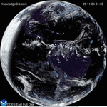
Beautiful night light of U.S. from NASA NOAA GOES-East Satellite. Watch as the sun rise and sun set triggers the cities to illuminate.

There has been a recent increase in discussions on social media about the “fact” that the Earth is actually flat. There have been sports figures and celebrities who draw attention…

(Source Modernize.com) – America’s energy policy has been the subject of much recent debate: From the Pope’s public advocacy of environmental stewardship to the EPA’s toughened regulations on pollution from petroleum refineries,…

Monday morning video captured what appears to be something re-entering the atmosphere over Thailand. There were several photos and videos of a mystery fireball that briefly illuminated the Bangkok sky. The…

There is a Geomagnetic event in progress and it may allow viewing of Auroras as low as New York to Wisconsin and Washington state. If the skys are clear you should go…

(NASA) – A very bright fireball seen over New York, Ohio, and Pennsylvania at 4:45:17 EST this morning, February 17th. It was captured by three NASA cameras. The video came…

(NASA) Droughts in the U.S. Southwest and Central Plains during the last half of this century could be drier and longer than drought conditions seen in those regions in the…


KnowledgeOrb Powered by WordPress
Max Magazine Theme was created by ![]()